
Utility Mapping
Utility Mapping
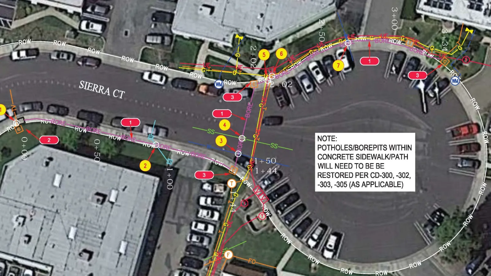
Once D&M has marked your facilities, they can map them for you using highly accurate GPS equipment—making them easier to find and easier to protect.
D&M Utility Mapping Services
- Keep track of facilities
- Reduce excavation damages
- Reduce cost of future construction
- Fulfill regulatory requirements
- Ticket Risk Assessment - Ready (High Risk Infrastructure assessment)